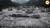
Nepal is urgently restoring its early-warning network along the China border after a glacial collapse killed more than 1,100 people and exposed major gaps in disaster monitoring.
Nepal has begun rebuilding an early-warning system along its northern border with China after a devastating glacial flood killed more than 1,100 people and left thousands missing. The upgraded network will combine seismic sensors, remote cameras and satellite-based communications to detect landslides and sudden flood events more quickly.
The first equipment is being installed at Timure in Rasuwa district, a key border settlement located along the same river corridor hit by the August 26 disaster. Two Nepali government sources told Reuters that the new system is intended to remain operational even if floods destroy local infrastructure or mobile networks.
Warning Network Failed
The disaster exposed serious weaknesses in Nepal's existing monitoring system. At least four hydrological gauging stations near the border were destroyed when the torrent of water, mud and rocks swept through the region.
The previous network mainly tracked gradual changes in river levels, particularly those associated with rainfall. It was not designed to respond rapidly to an enormous debris flow generated by a sudden glacial collapse.
Reuters reported that the disaster struck a border crossing at about 8:32 am, while a public warning was not issued until 9:13 am, leaving communities with a critically short response window.
Sensors And Cameras
The rebuilt network will use seismic sensors to identify ground movement and other signals associated with landslides. Remote cameras will provide visual information from vulnerable areas, allowing officials to assess developing hazards.
The equipment will initially be deployed at one location, with additional sites expected to follow. Nepali authorities have already conducted helicopter surveys to identify suitable high-altitude locations for the monitoring equipment.
The National Disaster Risk Reduction and Management Authority (NDRRMA) is leading the installation effort, although officials have not formally announced the complete rebuilding programme.
Satellite Link Planned
A key component of the new system will be a Very Small Aperture Terminal (VSAT) satellite connection.
The satellite link is designed to keep monitoring stations connected when mobile towers, electricity infrastructure or conventional communications are knocked out by a disaster. Officials said uninterrupted transmission of monitoring data could help authorities identify fresh hazards and issue alerts faster.
The need for such resilience became clear when the previous monitoring stations were swept away during the flood and could no longer transmit information.
More Landslides Feared
Authorities remain concerned about unstable Himalayan terrain following the massive glacial event. Government sources warned that the landscape is still adjusting and could trigger additional landslides.
Two barrier lakes created after the glacial collapse have already drained, reducing the immediate threat from those water bodies. However, officials continue to monitor the region because further landslides could send water and debris into downstream settlements.
Experts say even a warning of only a few minutes could make a major difference if communities receive it before another debris flow reaches populated areas.
China Data Becomes Critical
The disaster has also renewed Nepal's demand for stronger real-time information sharing with China.
Several Himalayan hazards originate or develop in high-altitude areas of the Tibetan region. Information on glacier movement, upstream water levels and potentially dangerous lakes can therefore be crucial for communities downstream in Nepal.
China has said it has shared satellite imagery, hydrological information and early-warning data concerning upstream barrier lakes with Nepal since the disaster. Kathmandu now wants deeper and faster cooperation on monitoring glacier-related risks.
Cross-Border Gaps Exposed
The disaster highlighted a broader problem: a warning system operating only inside Nepal cannot provide adequate protection when a hazard develops across or near an international border.
Nepal and China have previously discussed disaster-risk cooperation and information exchange, but reporting after the disaster has pointed to gaps in real-time coordination and formal warning protocols.
The new network is therefore expected to focus not only on river levels but also on landslides, seismic activity and visual changes in high-risk terrain.
Nepal Moves To Rebuild
Nepal's immediate priority is to restore monitoring capacity while rescue and recovery operations continue. With more than 1,100 deaths reported and thousands still missing, the disaster has become one of the country's most severe recent humanitarian emergencies.
The rebuilt warning system will not eliminate the danger posed by sudden Himalayan disasters, but officials hope a combination of ground sensors, cameras, satellite connectivity and better cross-border data sharing will provide crucial minutes for evacuation.
The experience has also reinforced the need for Nepal, China and other Himalayan countries to develop faster systems for sharing information about glaciers, landslides and flood risks before another catastrophe strikes.