


US Trade Map Shows PoK, Aksai Chin as Indian Territory, Sparks Online Attention After Interim Deal
Digital Desk
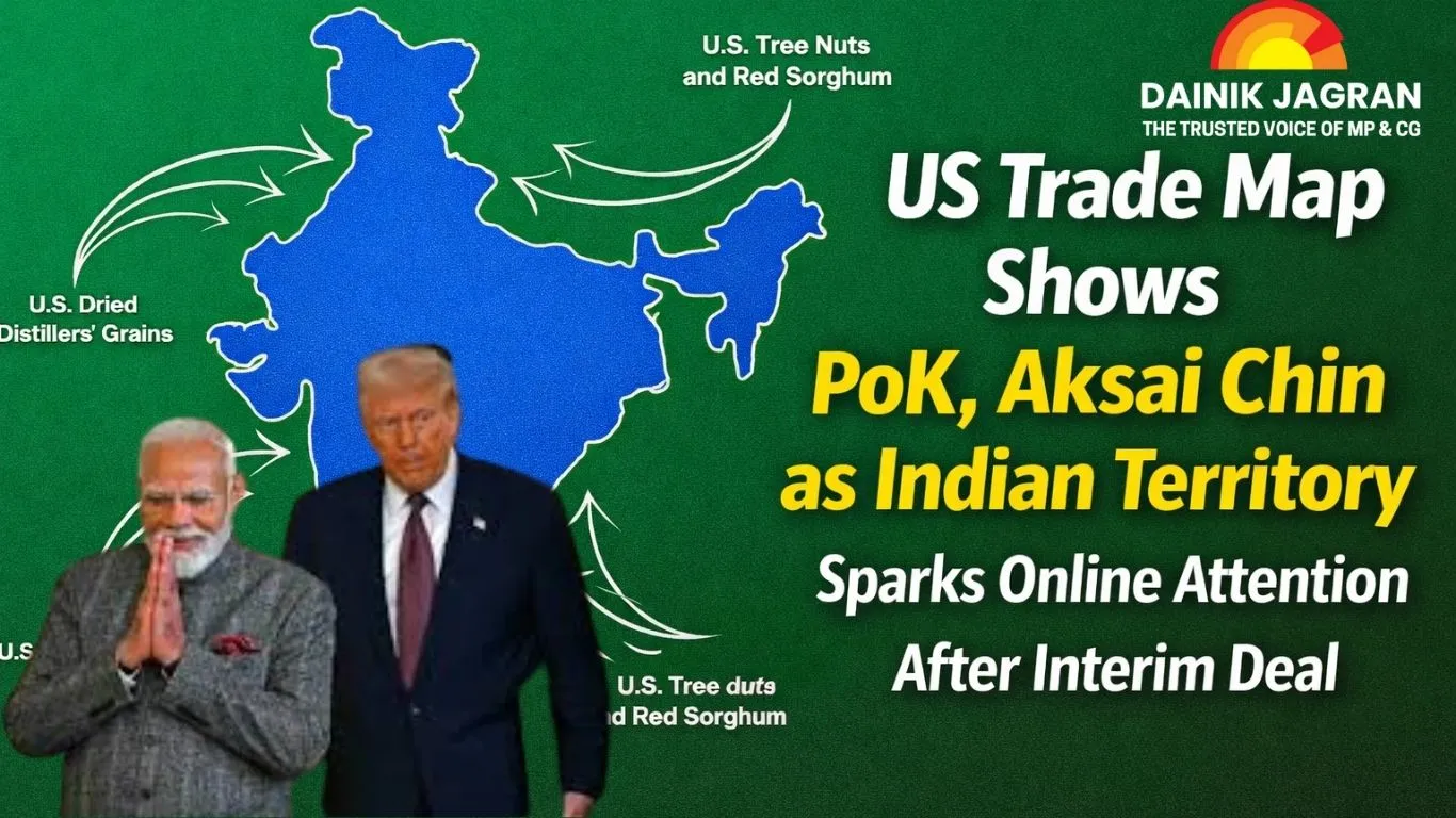
The map, released on Friday alongside the trade framework, quickly went viral on social media. Unlike earlier US and Western government representations that marked these regions as disputed through dotted lines or distinct shading, the latest depiction shows the territory within India’s borders without qualification. While US officials have not clarified whether the representation was deliberate, observers view it as notable amid evolving geopolitical and economic ties between New Delhi and Washington.
India has consistently maintained that Jammu and Kashmir in its entirety, including PoK and Aksai Chin, is an integral part of the country. The government has reiterated this position at international forums and in bilateral engagements, rejecting external characterisations of the region as disputed.
The PoK issue traces its origins to the 1947 Partition, when Jammu and Kashmir acceded to India following an invasion by armed tribal militias from Pakistan’s side. The first India–Pakistan war ended in 1949 with a UN-brokered ceasefire, leaving Pakistan in control of parts of the territory west and north of the Line of Control. India continues to assert that the accession was legal and final. In 2019, New Delhi reorganised the former state into the Union Territories of Jammu and Kashmir and Ladakh after abrogating Article 370.
Aksai Chin, meanwhile, remains at the centre of the India–China boundary dispute. The high-altitude region in eastern Ladakh has been under Chinese control since the 1962 war. India considers it part of Ladakh, while China administers it as part of Xinjiang and Tibet. The area is strategically significant due to infrastructure links between Tibet and Xinjiang, and tensions along the Line of Actual Control continue to shape bilateral relations.
The map surfaced as India and the US unveiled the framework of their Interim Trade Agreement, which outlines significant tariff reductions and expanded market access. Under the framework, US tariffs on select Indian goods have been cut by half to 18%, while an additional 25% duty imposed over India’s purchase of Russian oil has been lifted. India has agreed to reduce or eliminate tariffs on several US industrial products.
Commerce Minister Piyush Goyal said the agreement could substantially improve access for Indian exporters to the US market and benefit sectors such as pharmaceuticals, textiles, gems and jewellery, and engineering goods. Both countries will continue negotiations toward a Comprehensive Bilateral Trade Agreement, positioning the interim pact as a stepping stone toward deeper economic integration.


.jpg)


