Japan Earthquake: Why Kumamoto Is Highly Vulnerable to Powerful Earthquakes

Digital Desk

Japan Earthquake: Why Kumamoto Is Highly Vulnerable to Powerful Earthquakes

A 7.1-magnitude earthquake has again exposed why Japan's Kumamoto Prefecture is one of the world's most earthquake-prone regions. Know the tectonic, volcanic and geological reasons behind the recurring seismic activity.

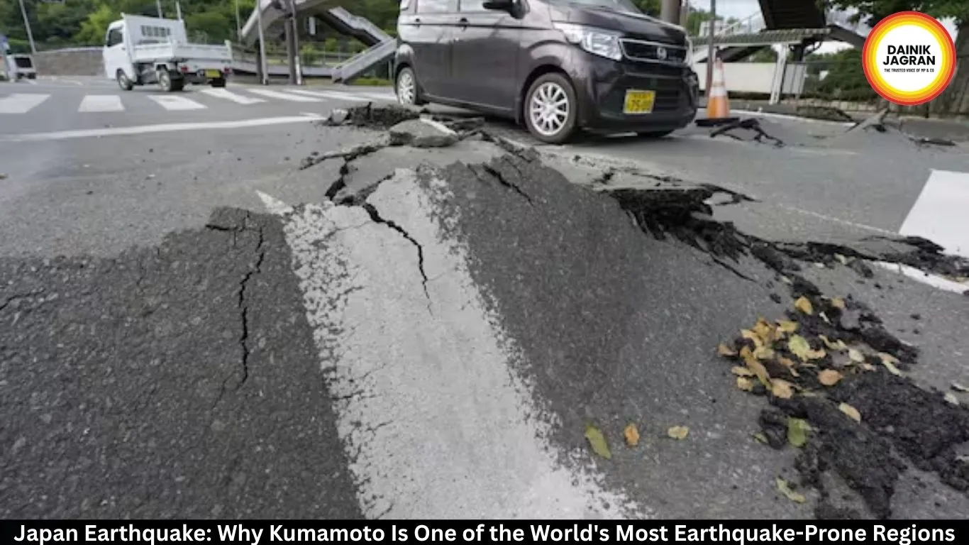
A powerful 7.1-magnitude earthquake that struck Japan's Kumamoto Prefecture has once again highlighted why the region remains one of the most seismically active zones in the world. The shallow quake has killed at least 13 people, injured hundreds and caused widespread damage to infrastructure, prompting large-scale rescue operations across central Kyushu.

Experts say Kumamoto's vulnerability stems from a unique combination of active fault lines, tectonic plate movement, volcanic activity and soft geological formations that amplify earthquake shaking.

Powerful Quake Causes Heavy Damage

The earthquake struck at 4:27 pm JST on July 28 with its epicentre near Uto City at a shallow depth of about 10 kilometres. Several areas, including Uki, Hikawa and Kumamoto City, experienced some of the strongest shaking recorded on Japan's seismic intensity scale.

The disaster damaged roads, disrupted rail services, caused power outages affecting tens of thousands of households and forced the suspension of flights at Kumamoto Airport while safety inspections were carried out.

Rescue teams, firefighters and personnel from Japan's Self-Defense Forces continue search operations for people trapped beneath collapsed buildings.

Why Kumamoto Experiences Frequent Earthquakes

Geologists explain that Kumamoto lies in one of Japan's most complex tectonic regions.

Japan is located at the meeting point of four major tectonic plates—the Pacific Plate, Philippine Sea Plate, Eurasian Plate and North American Plate. Near Kyushu, the Philippine Sea Plate continuously moves beneath the Eurasian Plate, generating enormous geological stress.

Unlike many other earthquake-prone areas, Kumamoto is also situated within the Beppu-Shimabara Graben, a large rift zone where the Earth's crust is actively stretching. This continuous movement creates frequent fractures and releases energy through powerful shallow earthquakes.

Active Fault Network Increases Risk

Scientists have linked the latest earthquake to the Hinagu Fault Zone, part of the well-known Futagawa-Hinagu fault system.

These faults are relatively shallow, meaning earthquakes originate just a few kilometres beneath the surface. Because seismic waves have very little distance to travel before reaching populated areas, the shaking becomes significantly stronger than in deeper earthquakes.

The same fault network was responsible for the devastating 2016 Kumamoto earthquake sequence, which caused extensive destruction across the region.

Volcanic Activity Adds to Seismic Instability

Kumamoto's location near Mount Aso, one of the world's largest active volcanic calderas, further increases geological instability.

Underground magma and superheated fluids circulate beneath the area, reducing friction along fault lines. Scientists believe these hydrothermal systems can make faults more likely to rupture when tectonic stress builds up.

Although earthquakes do not necessarily trigger volcanic eruptions, the interaction between volcanic systems and active faults contributes to the region's heightened seismic activity.

Soft Soil Amplifies Ground Shaking

Another factor worsening earthquake impacts is the geology of the Kumamoto Plain.

Large parts of the region consist of volcanic ash, loose sediments and water-saturated soil deposited over thousands of years. When seismic waves pass through these softer layers, they slow down but increase in intensity, leading to stronger ground motion.

This phenomenon also raises the risk of soil liquefaction, where saturated ground temporarily loses strength and behaves like a liquid, causing buildings and roads to sink or tilt.

Japan's Preparedness Continues to Evolve

Following previous major earthquakes, including the 2016 Kumamoto disaster, Japan significantly strengthened its disaster preparedness measures.

Modern buildings incorporate advanced seismic-resistant designs, bridges and railways have been retrofitted, and earthquake early warning systems automatically halt trains and industrial operations when strong tremors are detected.

Authorities are also closely monitoring aftershocks using Japan's nationwide seismic observation network while engineers assess damage to critical infrastructure.

Despite these preparations, experts warn that Kumamoto's unique geological setting means the region will continue to face a high risk of powerful earthquakes in the future.


--------

๐Ÿšจ Beat the News Rush โ€“ Join Now!

Get breaking alerts, hot exclusives, and game-changing stories instantly on your phone. No delays, no fluff โ€“ just the edge you need. โšก

Tap to join:ย 

๐ŸŸข WhatsApp Channel: Dainik Jagran MP CG

Crave more?

๐Ÿ…• Facebook: Dainik Jagran MP CG English

๐Ÿ…ง Twitter (X): Dainik Jagran MP CG

๐Ÿ…˜ Instagram: Dainik Jagran MP CG

Share the fire โ€“ keep your crew ahead! ๐Ÿ—ž๏ธ๐Ÿ”ฅ

english.dainikjagranmpcg.com
29 Jul 2026 By Abhishek Joshi

Japan Earthquake: Why Kumamoto Is Highly Vulnerable to Powerful Earthquakes

Digital Desk

A powerful 7.1-magnitude earthquake that struck Japan's Kumamoto Prefecture has once again highlighted why the region remains one of the most seismically active zones in the world. The shallow quake has killed at least 13 people, injured hundreds and caused widespread damage to infrastructure, prompting large-scale rescue operations across central Kyushu.

Experts say Kumamoto's vulnerability stems from a unique combination of active fault lines, tectonic plate movement, volcanic activity and soft geological formations that amplify earthquake shaking.

Powerful Quake Causes Heavy Damage

The earthquake struck at 4:27 pm JST on July 28 with its epicentre near Uto City at a shallow depth of about 10 kilometres. Several areas, including Uki, Hikawa and Kumamoto City, experienced some of the strongest shaking recorded on Japan's seismic intensity scale.

The disaster damaged roads, disrupted rail services, caused power outages affecting tens of thousands of households and forced the suspension of flights at Kumamoto Airport while safety inspections were carried out.

Rescue teams, firefighters and personnel from Japan's Self-Defense Forces continue search operations for people trapped beneath collapsed buildings.

Why Kumamoto Experiences Frequent Earthquakes

Geologists explain that Kumamoto lies in one of Japan's most complex tectonic regions.

Japan is located at the meeting point of four major tectonic plates—the Pacific Plate, Philippine Sea Plate, Eurasian Plate and North American Plate. Near Kyushu, the Philippine Sea Plate continuously moves beneath the Eurasian Plate, generating enormous geological stress.

Unlike many other earthquake-prone areas, Kumamoto is also situated within the Beppu-Shimabara Graben, a large rift zone where the Earth's crust is actively stretching. This continuous movement creates frequent fractures and releases energy through powerful shallow earthquakes.

Active Fault Network Increases Risk

Scientists have linked the latest earthquake to the Hinagu Fault Zone, part of the well-known Futagawa-Hinagu fault system.

These faults are relatively shallow, meaning earthquakes originate just a few kilometres beneath the surface. Because seismic waves have very little distance to travel before reaching populated areas, the shaking becomes significantly stronger than in deeper earthquakes.

The same fault network was responsible for the devastating 2016 Kumamoto earthquake sequence, which caused extensive destruction across the region.

Volcanic Activity Adds to Seismic Instability

Kumamoto's location near Mount Aso, one of the world's largest active volcanic calderas, further increases geological instability.

Underground magma and superheated fluids circulate beneath the area, reducing friction along fault lines. Scientists believe these hydrothermal systems can make faults more likely to rupture when tectonic stress builds up.

Although earthquakes do not necessarily trigger volcanic eruptions, the interaction between volcanic systems and active faults contributes to the region's heightened seismic activity.

Soft Soil Amplifies Ground Shaking

Another factor worsening earthquake impacts is the geology of the Kumamoto Plain.

Large parts of the region consist of volcanic ash, loose sediments and water-saturated soil deposited over thousands of years. When seismic waves pass through these softer layers, they slow down but increase in intensity, leading to stronger ground motion.

This phenomenon also raises the risk of soil liquefaction, where saturated ground temporarily loses strength and behaves like a liquid, causing buildings and roads to sink or tilt.

Japan's Preparedness Continues to Evolve

Following previous major earthquakes, including the 2016 Kumamoto disaster, Japan significantly strengthened its disaster preparedness measures.

Modern buildings incorporate advanced seismic-resistant designs, bridges and railways have been retrofitted, and earthquake early warning systems automatically halt trains and industrial operations when strong tremors are detected.

Authorities are also closely monitoring aftershocks using Japan's nationwide seismic observation network while engineers assess damage to critical infrastructure.

Despite these preparations, experts warn that Kumamoto's unique geological setting means the region will continue to face a high risk of powerful earthquakes in the future.


https://english.dainikjagranmpcg.com/international/japan-earthquake-why-kumamoto-is-highly-vulnerable-to-powerful-earthquakes/article-24112

Trending News