Philippines 7.8 quake kills 32; 1.4m tsunami wave recorded
Digital Desk
7.8-magnitude Philippines earthquake injures 134, triggers evacuations and aftershocks; tsunami wave up to 1.4m recorded
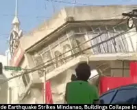
A powerful 7.8-magnitude earthquake struck off Mindanao early Monday, killing at least 32 people, injuring 134 and collapsing several commercial buildings, officials and local reports said. The temblor — one of the strongest to hit the Philippines in recent years — also produced tsunami waves measured at up to 1.4 metres (about 4.6 feet) and prompted mass evacuations along coastal areas.
Quake and immediate impact
According to the US Geological Survey (USGS), the quake occurred at 5:07 am Indian Standard Time with an epicentre located roughly 35 km beneath the surface near Mindanao. Initial reports and local officials said shops, offices and other commercial structures sustained heavy damage in cities and towns near the epicentre, and some buildings collapsed.
Philippine authorities put the confirmed death toll at 32 but cautioned the figure remained provisional pending verification by the national disaster agency. “Fatalities are still being validated,” a spokesperson said. Local civil defence offices reported at least seven people missing and 134 injured as rescue teams moved into the hardest-hit areas.
Tsunami alerts and waves
The Philippine Institute of Volcanology and Seismology (PHIVOLCS) recorded tsunami activity in six Mindanao locations, with the highest sea surge reaching 1.4 metres. PHIVOLCS later lifted tsunami alerts for southern provinces after an extended observation period found the disturbances too small to cause further damage, the agency said in an advisory.
Neighbours briefly issued warnings. Indonesia and Malaysia raised tsunami advisories for some coastal sectors, and agencies including Japan’s meteorological service and the US tsunami warning system issued alerts for parts of the wider region. Most regional warnings were withdrawn within hours as wave heights diminished and risks receded.
Aftershocks and ongoing danger
By 11 am local time PHIVOLCS had logged 138 aftershocks ranging from magnitude 1.3 to 6.7. Officials warned that strong aftershocks can continue for days and may further damage already weakened structures, complicating rescue operations. “Aftershocks remain a serious concern,” a disaster-response official said, urging people to avoid unstable buildings.
Ground reports and local response
Scenes from General Santos City and neighbouring provinces showed people rushing into the streets at dawn, with power outages reported in parts of the city. Regional authorities published photographs showing cracked walls, damaged shopfronts and a partially collapsed police station in Alabel town, Sarangani province.
Philippine President Ferdinand Marcos Jr ordered immediate evacuations in coastal zones and suspended classes across parts of Mindanao. He directed government agencies to begin relief and search-and-rescue operations, the presidential office said. Tens of thousands of residents were reported moving to higher ground in the hours after the quake.
Why the Philippines is vulnerable
The Philippines sits along the Pacific “Ring of Fire,” an arc of intense seismic and volcanic activity that stretches across the Pacific Basin. Tectonic plate movements make the country prone to frequent earthquakes and volcanic eruptions, and it also faces about 20 typhoons annually. The recent disaster follows a deadly October 2025 quake in Cebu that killed dozens and injured many more.
Humanitarian and infrastructure concerns
Rescue teams are prioritising trapped and injured people while assessing damage to roads, communications and power lines that hamper response efforts. Local hospitals reported a surge of patients; medical teams are triaging injuries and preparing for possible increases should aftershocks trigger new collapses.
What comes next
Authorities said search-and-rescue operations would continue through the day and formal casualty verification would be completed as teams reach isolated areas. Phivolcs and disaster-response agencies urged residents to stay clear of damaged structures and to heed evacuation orders. International monitoring agencies will continue to track aftershocks and any further sea-level changes.
Related coverage will follow as officials release verified casualty lists and more details on the scale of infrastructure damage and relief measures.