Monsoon Stalls Across India as Five Weather Systems Interfere
Digital Desk
The southwest monsoon has remained stuck for 11 days, leaving 19 states awaiting widespread rainfall as multiple weather systems and emerging El Niño signals slow its progress.
The southwest monsoon has lost momentum after making rapid progress across large parts of the country earlier this month, leaving several states waiting for sustained rainfall. Weather officials say a combination of five active atmospheric systems is currently affecting monsoon circulation, resulting in a significant slowdown and widening rainfall deficits across India.
The monsoon, which reached Telangana on June 8, has remained virtually stationary since then. Over the past 11 days, it has failed to advance further into several regions, raising concerns among farmers and state administrations as temperatures continue to remain high in many areas.
According to rainfall data between June 1 and June 18, India has recorded 38% below-normal precipitation. Maharashtra and Gujarat have emerged among the worst-affected states, reporting rainfall deficits of around 78% and 79%, respectively.
Moisture Flow Weakens
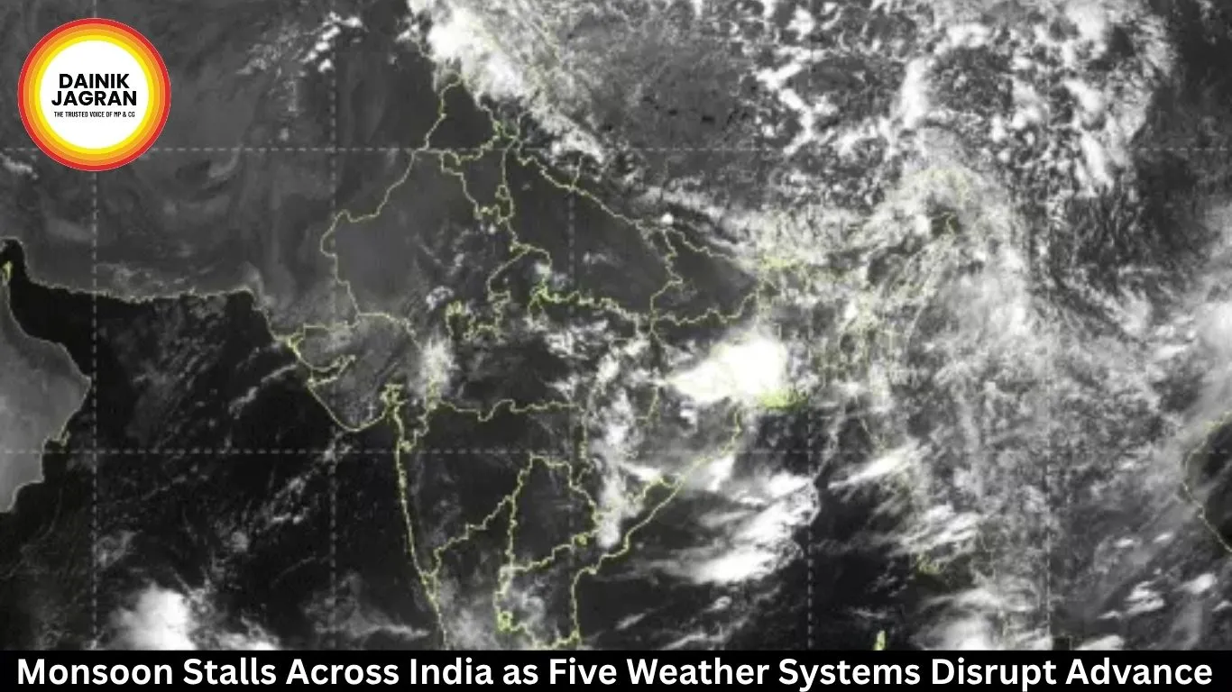
Meteorologists attribute the slowdown to a rare situation where multiple weather systems are operating simultaneously and interfering with the normal monsoon pattern.
Moisture-bearing winds from the Arabian Sea have weakened, while cloud bands moving northward from southern India have failed to advance as expected. These disruptions have prevented the monsoon current from strengthening over central and northern parts of the country.
As a result, widespread monsoon rainfall remains absent across several regions despite favourable calendar dates for its arrival.
Heat Persists Despite Showers
Pre-monsoon activity continues in parts of Madhya Pradesh, Uttar Pradesh, Bihar, Rajasthan, Haryana, Delhi and Chhattisgarh. However, these scattered showers have not been enough to bring lasting relief from the heat.
Several locations across seven states recorded temperatures above 40°C on Wednesday. Banda in Uttar Pradesh emerged as the hottest place in the country at 43.2°C.
Temperatures also crossed 42°C in parts of Odisha and Maharashtra, while districts in Bihar, Jharkhand, Chhattisgarh and Madhya Pradesh continued to experience intense daytime heat.
The combination of delayed monsoon rainfall and persistent high temperatures has increased discomfort levels, particularly in rural areas dependent on early-season agricultural activity.
El Niño Concerns Return
Adding to concerns, recent observations from the US National Oceanic and Atmospheric Administration (NOAA) suggest early signs of developing El Niño conditions.
According to the report, the Intertropical Convergence Zone (ITCZ), a critical weather belt that helps draw moisture towards the Indian subcontinent, has not shifted northward at its usual pace. The delayed movement has contributed to the sluggish advance of the monsoon.
Satellite imagery indicates active thunderstorm development over eastern India, while cloud cover remains comparatively weak across Madhya Pradesh, Rajasthan, Gujarat and large parts of western India.
Experts caution that if El Niño conditions strengthen, rainfall distribution during the season could become uneven, increasing the likelihood of prolonged dry spells in some regions.
Heavy Rain In North Bengal
While many states await monsoon rains, parts of West Bengal have witnessed the opposite situation.
Heavy rainfall in Darjeeling district led to the collapse of a bridge over the swollen Balason River, disrupting road connectivity between Siliguri and the Mirik subdivision. North Bengal districts including Darjeeling, Kalimpong and Jalpaiguri have received intense rainfall over the past two days following the monsoon's arrival in the state on June 9.
Authorities are monitoring vulnerable areas as rain-related incidents continue to be reported.
Relief Expected Soon
The India Meteorological Department (IMD) has indicated that conditions may improve over the next four to five days.
Officials say the current jet stream pattern, which has been restricting monsoon movement, is expected to weaken gradually. This could allow the monsoon to regain strength and advance into Maharashtra, Karnataka, Chhattisgarh and adjoining regions.
Rainfall activity is also expected to increase across eastern India, the Northeast and parts of central India over the next few days.
States Remain On Alert
Several states have already issued weather advisories. Rajasthan has placed more than 30 districts under thunderstorm and rainfall alerts, while Bihar remains under an orange alert for strong winds and rain. Uttarakhand has warned Char Dham pilgrims and residents in vulnerable districts to remain cautious amid forecasts of fresh showers.
In Madhya Pradesh, where rainfall remains 39% below normal, the monsoon is now expected to arrive around June 25, nearly 10 days later than its usual schedule.
With the sowing season approaching in many regions, the progress of the monsoon over the coming week will be closely watched by farmers, policymakers and weather experts alike.


.jpg)

.jpg)