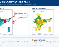
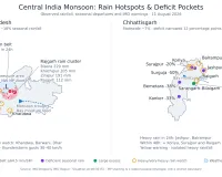
Chhattisgarh’s cumulative monsoon rainfall has moved into the normal category after recovering substantially from its July deficit, but the distribution remains sharply uneven across the state.
According to the Meteorological Centre in Raipur, Chhattisgarh recorded 661.2 mm of rainfall between June 1 and August 11 against a normal of 709.5 mm. The state is therefore 7% below normal, representing a rainfall shortfall of approximately 48.3 mm.
IMD classifies departures between minus 19% and plus 19% as normal. Chhattisgarh is consequently considered to have received normal seasonal rainfall despite the remaining numerical deficit.
How Much Rain Deficiency Has Been Covered?
Chhattisgarh had recorded 404.5 mm of rain by July 26, when its seasonal deficit stood at approximately 19%.
The deficit has now fallen to 7%, meaning the state has recovered about 12 percentage points in a little over two weeks.
However, the recovery has not followed a straight line. By August 2, the deficit had temporarily narrowed to around 3%. It has since widened again to 7% because rainfall has remained uneven and the season’s cumulative normal continues rising every day.
Districts Still Facing Rainfall Deficiency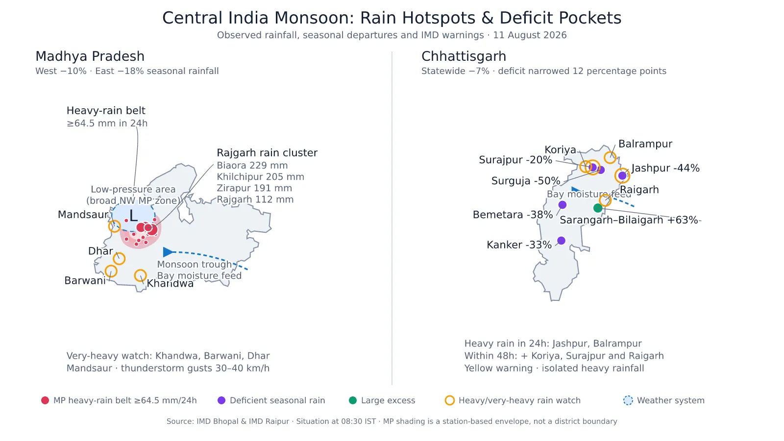
Five districts remain in IMD’s deficient category:
| District | Seasonal departure |
|---|---|
| Surguja | 50% deficient |
| Jashpur | 44% deficient |
| Bemetara | 38% deficient |
| Kanker | 33% deficient |
| Surajpur | 20% deficient |
At the other end, Sarangarh-Bilaigarh has recorded a 63% surplus, categorised as a large excess. Narayanpur, Mungeli, Baloda Bazar, Mahasamund and Janjgir have also received excess rainfall.
This variation means a state-level figure can hide significant local shortages and excesses.
Why Will the Rain Continue?
The monsoon trough currently runs from Rajasthan through the low-pressure system over north-west Madhya Pradesh, then through Sidhi, Ranchi and Digha towards the Bay of Bengal.
A shear zone is also present across central and adjoining peninsular India. In addition, an upper-air cyclonic circulation over the north-west Bay of Bengal is expected to produce a fresh low-pressure area around August 12.
This developing system is likely to draw moisture inland across Odisha and Chhattisgarh, producing another spell of rain—particularly in northern districts.
Is the Rain Beneficial for Chhattisgarh Farmers?
For paddy farmers, the recovery from the July deficit is broadly positive. It has improved soil moisture, supported transplantation and reduced the immediate need for irrigation in rain-fed areas.
Reservoirs, village tanks and groundwater sources will also benefit if rainfall remains moderate and well distributed.
The agricultural benefit is not uniform, however. Heavy rain can submerge low-lying paddy fields, wash away newly applied fertiliser and damage maize, pulses, oilseeds and vegetables where drainage is poor.
Rain in deficient districts such as Jashpur, Surguja, Kanker and Surajpur would be useful, but intense downpours may produce rapid run-off instead of allowing the soil to absorb water.
Farmers should:
- Maintain paddy-field bunds while providing outlets for excessive water.
- Drain standing water from pulses, maize, oilseeds and vegetables.
- Postpone fertiliser and pesticide application during rain.
- Keep harvested produce under waterproof covers.
- Avoid working in open fields during lightning.
- Keep cattle in protected shelters and away from ponds and swollen streams.
Chhattisgarh Rain Forecast
The Raipur Meteorological Centre has forecast light to moderate rain at many places across the state through August 17.
- August 11–14: Heavy rain possible at isolated places.
- August 11–15: Thunderstorms and lightning remain possible.
- Next 24 hours: Heavy rain likely at isolated places in Jashpur and Balrampur.
- Next 48 hours: Heavy rain risk expands to Jashpur, Koriya, Surajpur, Balrampur and Raigarh.
- Raipur: Generally cloudy conditions with rain or thunderstorms are expected.
The current district warning is yellow, indicating that residents should remain updated and prepared for waterlogging, reduced visibility and the possible submergence of low-lying roads and fields.


Chhattisgarh Rain Forecast: Monsoon Deficit Narrows to 7%, but Five Districts Remain Short of Rain
Digital desk
Chhattisgarh’s cumulative monsoon rainfall has moved into the normal category after recovering substantially from its July deficit, but the distribution remains sharply uneven across the state.
According to the Meteorological Centre in Raipur, Chhattisgarh recorded 661.2 mm of rainfall between June 1 and August 11 against a normal of 709.5 mm. The state is therefore 7% below normal, representing a rainfall shortfall of approximately 48.3 mm.
IMD classifies departures between minus 19% and plus 19% as normal. Chhattisgarh is consequently considered to have received normal seasonal rainfall despite the remaining numerical deficit.
How Much Rain Deficiency Has Been Covered?
Chhattisgarh had recorded 404.5 mm of rain by July 26, when its seasonal deficit stood at approximately 19%.
The deficit has now fallen to 7%, meaning the state has recovered about 12 percentage points in a little over two weeks.
However, the recovery has not followed a straight line. By August 2, the deficit had temporarily narrowed to around 3%. It has since widened again to 7% because rainfall has remained uneven and the season’s cumulative normal continues rising every day.
Districts Still Facing Rainfall Deficiency
Five districts remain in IMD’s deficient category:
| District | Seasonal departure |
|---|---|
| Surguja | 50% deficient |
| Jashpur | 44% deficient |
| Bemetara | 38% deficient |
| Kanker | 33% deficient |
| Surajpur | 20% deficient |
At the other end, Sarangarh-Bilaigarh has recorded a 63% surplus, categorised as a large excess. Narayanpur, Mungeli, Baloda Bazar, Mahasamund and Janjgir have also received excess rainfall.
This variation means a state-level figure can hide significant local shortages and excesses.
Why Will the Rain Continue?
The monsoon trough currently runs from Rajasthan through the low-pressure system over north-west Madhya Pradesh, then through Sidhi, Ranchi and Digha towards the Bay of Bengal.
A shear zone is also present across central and adjoining peninsular India. In addition, an upper-air cyclonic circulation over the north-west Bay of Bengal is expected to produce a fresh low-pressure area around August 12.
This developing system is likely to draw moisture inland across Odisha and Chhattisgarh, producing another spell of rain—particularly in northern districts.
Is the Rain Beneficial for Chhattisgarh Farmers?
For paddy farmers, the recovery from the July deficit is broadly positive. It has improved soil moisture, supported transplantation and reduced the immediate need for irrigation in rain-fed areas.
Reservoirs, village tanks and groundwater sources will also benefit if rainfall remains moderate and well distributed.
The agricultural benefit is not uniform, however. Heavy rain can submerge low-lying paddy fields, wash away newly applied fertiliser and damage maize, pulses, oilseeds and vegetables where drainage is poor.
Rain in deficient districts such as Jashpur, Surguja, Kanker and Surajpur would be useful, but intense downpours may produce rapid run-off instead of allowing the soil to absorb water.
Farmers should:
- Maintain paddy-field bunds while providing outlets for excessive water.
- Drain standing water from pulses, maize, oilseeds and vegetables.
- Postpone fertiliser and pesticide application during rain.
- Keep harvested produce under waterproof covers.
- Avoid working in open fields during lightning.
- Keep cattle in protected shelters and away from ponds and swollen streams.
Chhattisgarh Rain Forecast
The Raipur Meteorological Centre has forecast light to moderate rain at many places across the state through August 17.
- August 11–14: Heavy rain possible at isolated places.
- August 11–15: Thunderstorms and lightning remain possible.
- Next 24 hours: Heavy rain likely at isolated places in Jashpur and Balrampur.
- Next 48 hours: Heavy rain risk expands to Jashpur, Koriya, Surajpur, Balrampur and Raigarh.
- Raipur: Generally cloudy conditions with rain or thunderstorms are expected.
The current district warning is yellow, indicating that residents should remain updated and prepared for waterlogging, reduced visibility and the possible submergence of low-lying roads and fields.